
3D/Elevation [1]
- 3D and Elevation options available when OziExplorer3D (separate product) is installed.
- works with both registered and unregistered OziExplorer and OziExplorer3D. (the unregistered limitations of each apply)
- most common formats of height/elevation data supported – SRTM, GTopo30, GLOBE, DTED, GridAscii (to use the 3D/Elevation features, height data for the map region is required)
- has the ability to download SRTM height data for the region of map being viewed
- view the elevation under the mouse cursor
- view a map profile along a track or map section
- create a 3D view of a map (requires OziExplorer3D to view the 3D map)
—


OziExplorer 3D – Sources of Digital Height Data [2]
Note: OziExplorer version 3.95.4j or later has the ability to download SRTM height data for the region of map being viewed so manual downloading through the FTP site shown below is not required. The SRTM Download option is on the 3D/Elevation Menu. (OziExplorer3D must be installed for this menu to be visible.)

The Results:
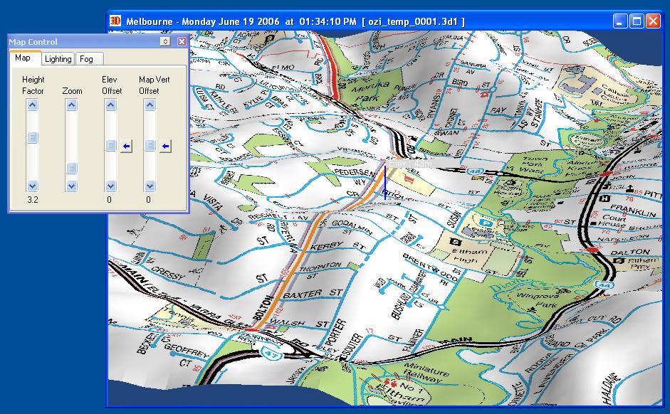
OziExplorer-3D map of Eltham (VIC)
(Click to enlarge)

OziExplorer-3D map of Sydney Harbour (NSW)
(Click to enlarge)

OziExplorer-3D map of the Blue Mountains (NSW)
( Click to Enlarge )
[1.] OziExplorer – Features [OziExplorer]
[2.] OziExplorer 3D – Sources of Digital Height Data [OziExplorer]
[3.] GPS & OziExplorer [ ]


